Happy New Year! 

At one point it felt so far away but 2018 is finally here and I’m 91 days away from starting my hike of the Pacific Crest Trail. It may seem like a trivial thing but being able to say “this April” instead of “next April” has made a huge difference in my mindset. The feeling of the PCT being something I will undertake “next year” has vanished and has been replaced with a feeling of excitement that increases every day.

I still have plenty to do to get ready, all those things I told myself I would get to after the holidays are now lined up in front of me. Not only the things like figuring out when I will be at certain points on the trail, finalizing my resupply plan and step up my training, but also finding a storage unit and moving pretty much everything I own into it.

Besides the logistics of moving here are the things I’m be focusing on to prepare myself for the hike:

  • Training – Plenty of cardio during the week and long hikes on the weekend with lots of stretching every day. Try to do everything I can to get my ready for the abuse I’m about to put it through. 
  • Practice – Spending time doing the things I will have to do on the trail like packing and unpacking my backpack, setting up my tent in all different kinds of weather and updating this blog from my phone.
  • Prepare mentally – The biggest challenge of through hiking the PCT might be the mental one. To prepare I have incorporated meditation into my daily routine (Yay Headspace) and remind myself of why I’m hiking the PCT, how I’ll feel after completing the trail and what it would feel like if I were to give up. 
  • Refine and finalize my gear – I broke down and bought a new, much lighter tent. While I love my Big Agnes Copper Spur HV UL2 I wanted to reduce my base weight and make more room in my backpack, so I switched to the Six Moons Designs Lunar Solo. Not only is it over 1lb lighter it also takes up far less room in my pack. Another change I made to save weight and space is to go stoveless (more on that later) although I am considering the crotch pot. I also received the InReach Explorer Satellite Communication Device / GPS for Christmas / my birthday. I still have a few small things to pick up like stuff sacks but am feeling good about my final set up.
  • Diet – Adjust my diet to eliminate foods known to cause inflammation. No refined sugar or alcohol and a lot less grains. Add in nutrient dense foods since those might be lacking in my trail diet. 
  • Finalize my schedule – I know I’m starting April 3rd and have 6 months to complete the hike, even though that’s probably more than I need, but I need to finalize my schedule so I know where I’ll be and when. That way others can make plans to meet up with me along the way or send care packages. This seems pretty straight forward but I don’t know how long it will take me to acclimate to hiking 20ish miles a day or when I’ll want to spend an extra day in a hotel. 
  • Food – At this moment I’m planning on picking up most of my food as I go, which means I’ll sometimes have to figure out how to put together a weeks worth of meals from stuff I can find in a gas station convince store. I will probably end up sending myself at least some food along the way. 

I’ll go into depth on my schedule and resupply plan in the coming weeks along with my final gear list. 

I hope your holidays were great and 2018 is off to a great start for you. Here’s to an amazing year ahead!

Donate, Support or Bet

One of the great things about doing something as crazy as hiking the entire Pacific Crest Trail is that I can leverage it to raise money for a cause that means a great deal to me personally. Today, over 35 million people across the world are living with Alzheimer’s, including more than 5 million Americans and a member of my family. In the U.S. alone, more than 15 million caregivers generously dedicate themselves to those with Alzheimer’s and dementia, including my Mom.

To honor those those affected by Alzheimer’s disease I am participating in The Longest Day to raise funds for the Alzheimer’s Association. Don’t let the name fool you, my hike will span many days and many of them will seem very, very long, I’m fundraising for the entire thing, not just a single day. Keep this in mind when you’re making your donation. I set a very modest goal of $2,650, the approximate distance of the Pacific Crest Trail in miles, as I know there are a number of very good causes that need your support.  However, keep in mind that I’m hiking 2,650 miles in support of this cause. What’s the going rate for a mile these days? Let me do the math for you. The first one is easy, $1 a mile would be $2,650 (do it), $0.50 a mile would be $1,325, $0.25 a mile would be $662.5 and finally $0.10 a mile would be $265.  Seriously though, anything you can contribute would be greatly appreciated, even if it’s just a penny a mile ($26.50) or $5.

Click Here To Make Your Donation

Secondly, if after you have made your donation to support the Alzheimer’s Association you have a few bucks you want to throw my way to directly support me on my journey you can do so by clicking here. A few bucks for a greasy burger or a night in even the sleaziest roadside motel will mean a lot. I’ll even send you something from my journey (most likely a print of one of my photos taken along the way) in return for your contribution if you like.

Thirdly, if you think i’m absolutely nuts and there is no way I’m ever going to finish the entire Pacific Crest Trail, lets make a bet. Seriously.  Feel free to contact me and I will gladly make that bet with you.

Finally, please share this and encourage others to donate. The direct link to my Longest Day page is http://act.alz.org/goto/further . Thank you!!


Reviewed and Approved

Back on November 1st the Pacific Crest Trail Association began accepting applications for 2018 Pacific Crest Tail permits. I was anxiously sat in front of my computer with multiple browsers open along with one on my phone.  I watch the timer tick down towards 10AM when the permits would go live. I read comments on Facebook where others talked of server crashes as everyone floods the site, which apparently happened last year. I began to have flashbacks to trying to snag concert tickets as soon as they went on sale knowing they would sell out  almost immediately.

When the timer hit 0 I refreshed everything and began filling out the same information in multiple windows as quickly as possible.  Even though I was just attempting to submit an application it was first come first serve and they only accepted  35 applications per day, matching the number of permits made available. However, it wasn’t a complete dash for the finish line as once you selected your start date you had 13 minutes to complete your application.  This seemed like plenty of time to fill things out, until I hit “Next” to move to the next page and  nothing happened.  After 2 minutes of waiting I got to the next screen and once again quickly filled out the required information in each browser before clicking “Next”… and waited. This happened on each page, with the little clock ticking down before my selected date would be released and I would have to start all over again.  “Are you Traveling by foot or by Horse, mule or other equine animal?” Foot but a mule might come in handy. Next. “Do you have a child under the age of 18 joining you?” no.. no man. Next.”Do you want to purchase the extra permit to camp on Mt. Whitney?” Yes, but ain’t nobody got time for that, I guess I’m day hiking it. Next.  This continued until I made my way to the final screen with 2 minutes left, the same amount time it had been taking to move from one page to the next.  I clicked submit and anxiously waited to see if I made it through in time. After what seemed like an eternity the confirmation page loaded, I made it.  I took a deep breath and thought “If just applying for a permit is this nerve wracking I’m going to be a mess when I’m about to start”

After a few weeks of obsessively checking the status of my permit application I received an email stating that my application had been reviewed and approved. I will be starting my journey on April 3rd 2018. With my start date finalized I submitted for my sabbatical from work, finalized my travel plans and began to second guess my start date.  I wanted to start a bit earlier than the ideal mid to late April start date to avoid a large rush of hikers but after seeing how quickly permits were taken realized that with as popular as the trail is, and a limited number of permits, it’s going to be the same amount of people regardless of when I start.  With starting early I run the risk of facing less than ideal snow conditions in the mountains, mainly the Sierra and the San Jacinto, here’s hoping it’s a mild winter in southern California.

Kendall Katwalk

What’s the best way to prepare for hiking the Pacific Crest Trail? By actually hiking on the Pacific Crest Trail of course. A few weeks ago I set out to do just that by revisiting one of my favorite hikes from last year,  the same hike which made me decide to hike the entire PCT, Kendall Katwalk.

I woke up early and made the drive up I-90 to the PCT trailhead at Snoqualmie Pass. As I pulled into the trailhead the fact that I will be spending 5 months, give or take, on this very trail  really started to really sink in. I felt a mix of excitement and anxiety as my mind was flooded with thoughts of  how amazing and challenging the journey will be. Not to mention all the things I had left to do to get ready. However, once I threw on my backpack and started down the trail the anxiety quickly subsided leaving nothing but excitement.

The trail starts off wooded with glimpses of the surrounding mountains through the trees. The trail itself is nice and smooth with a couple of small streams to cross before opening up into talus. Hiking on rocks is not my favorite but the views more than made up for it.

You make your way back into the tress as you continue up, crossing a few more streams before hitting a clearing which offers a view of the ridge above. In some spots you have to work your way through the abundant foliage.

You will hit a few switch backs and will continue to be provided with fantastic views of the Alpine Lakes Wilderness area.

Continuing on the trail you will be greeted by some prominent peaks straight ahead of you letting you know that you’re getting close to the ridge. After turning a corner you begin the final push to the katwalk. A you get closer your can start to see valleys on both sides of you.

Once you make your way to your way to the katwalk it becomes clear that you are at the top of the ridge.  Turn left and your looking down into one valley, turn right and you’re looking down into the other.

The katwalk itself is a narrow path blasted out of the side of a cliff, a few hundred yards long.  When I arrived I was the only one around so I took the opportunity to take it all in.

As you make your way along the katwalk you have a spectacular view of the mountains to the east…

… and the valley below.  If you look close enough you can see Silver Creek at the bottom.


Heading back I began to wonder what it will feel like when I hit this section of the PCT next year. Realizing that at that point I will have hiked over 2,000 miles and had taken a day or two to visit family and friends I haven’t seen in months,  only to get back on the trail and continue on to Manning Park in Canada, with some tough hiking ahead in the North Cascades. Luckily being so close to Seattle I’m sure I’ll have a few people join up with me for parts of the final push.

I’m still here

I know.. I know.. it’s been a number of weeks since I posted an update.  Things are happening, which I will share here soon, but I’ve been busy enjoying all the things I won’t be able to do while i’m out on the trail next year.  With the lack of daylight, and my start date quickly approaching,  you can expect more regular posts going forward.

Bring Your Own Llama

Annette Lake will always hold a special place in my heart and not just because the sign at the trailhead promotes the fact that llamas are allowed on the trail, although that is one of the many reasons.  

When I first rediscovered hiking a few years ago Annette lake was one of the first hikes on my list. I recall convincing my friend Derek to join me on my first trip. We started up the trail in the afternoon not really knowing what to expect,  moving slowly and trying to figure out how far was had left ahead of us.  We didn’t have maps or cell reception but tried to make educated guesses based on the elevation data from the GPS on our phones. Not only were we lacking in navigational resources but many other essentials as well, as would become very apparent.  As we continued on the trail we began to hear thunder in the distance which not only became closer and louder,  but from multiple directions.  Luckily we were smart enough,  or more likely tired enough,  to decide to turn around.  The thunder continued to intensify until the sky opened up and poured down rain. Not wanting to get struck by lightning we began to run down the trail, trying not to slip and fall. After coming close to rolling my ankle a few times,  maybe falling once, and getting soaked to the bone we ended up back at the car and drove home.  I’d later find out that my camera, a decent DSLR, somehow got damaged to the point that it wouldn’t turn on and I had to buy a new one. 
Despite a challenging first attempt I was determined to make it to the lake. After getting a few more hikes under my belt, and making sure I had proper rain gear,  I cautiously returned to finish the hike.  As soon as I started down the trail I was surprised by a very unexpected text message from a friend,  and avid hiker, that I hadn’t heard from in a long time.  I took it as a sign that I picked the right day to come back. The hike and the lake was stunning and it felt great to finally make it all the way. 

Since then I have returned a few times,  sometimes as an introductory hike for friends. When I discovered that Cristina had never been it moved to the top of our list and in early July we crossed it off. 

Before heading up the main trail you can take a quick detour down a short trail to a nice little waterfall.  The trail itself is pretty gentle,  crossing under some power lines and across a forest road before hitting a series of switchbacks. 

As you continue on you’ll come across one of my favorite “bridges”, a couple platforms lead to the “bridge” which consists of steps cut into a large downed tree with a wooden hand rail. 

A little further up there is another smaller waterfall that cuts down through the trees.  

As you near the top you’ll pass across a couple avalanche chutes where the break in the trees reveals some nice views, which apparently I didn’t take any pictures of this time.  The trail flatens out as you approach the lake. 

The lake itself sits below some impressive peaks and just asks to be swam in.

Cristina and I made our way around the lake until we found a place to escape the heat, set up our hammocks and relax for a while. 

When we finally gave into the fact that we couldn’t stay forever we made our way back down and just like every other time I visited Annette lake I didn’t come across someone with a llama, maybe I need to become the guy with a llama. 

What To Wear 

In an earlier post I covered all the gear i’ll be using on the PCT, now it’s time to talk clothing.  One question you may have is how much clothing I’ll bring with me and the answer is only what is necessary.  This means that I’ll be wearing the same thing for most of my time on the PCT, washing it periodically and only replacing items as the wear out.  Here are the basics.

Columbia Thistletown Park T-Shirt – Basic T-shirt that is advertised to wick away moisture. I’ll probably swap  this with a Merino wool shirt. Merino wool is great in both cool and warm weather, wicks moisture away, is quick drying and resists odor.

Columbia Silver Ridge Convertible Pants – My go-to hiking pants as they are light, wick away moisture, offer sun protection and easily convert into shorts.  Although I found that they can restrict movement in some situations so I may switch it up and go with a pair of shorts that allow for better movement.

Darn Tough Hiker 1/4 Socks – Merino wool socks! Really durable, comfortable and odor resisitant, what more do you need?

Altra Lone Peak 3.5 Shoes – Obviously footwear is very important. These are arguably the best through-hiking shoes. They are light with natural foot positioning, gaiter attachment points, drainage holes and are quick drying.  I definitely go through a few pair of these.

Two Beers Hat – I need something to wear on my head and Two Beers is awesome.

So that is what i’ll be wearing most of the time, but since the the PCT crosses through almost every type of climate I’ll need to switch it up a bit as conditions change. The first thing I need to be prepared for is the desert, where sun protection is of the utmost importance. While in the desert I’ll swap out my t-shirt for a white long sleeve shirt, which provides SPF 50 protection, and swap out my hat for a big dumb floppy sun hat. I’ll also have my pair of Julbo MonteBianco Sunglasses. Another item i’m considering is a pair of light weight gloves to protect my hands from sun exposure, I’ve heard of hikers getting pretty nasty sunburns on the top of their hands when using trekking poles in the desert.

When I get into colder climates I’ll start layering up with my favorite material for outdoor activities, Merino wool! I have a pair of Icebreaker Lightweight Leggings and a Icebreaker Lightweight Hoodie (Which I would link to but apparently it’s no longer available), and an Icebreaker  Sierra Beanie. These do a great job of keeping me warm in cold weather while i’m moving but for the times it gets really cold or i’m relaxing after a day of hiking I also have the Mountain Hardware Ghostwhisper Down Hooded Jacket, which is super light, really warm and packs down nice and small.  Other items that will keep me warm are a Merino Wool Buff for my neck and face and Mammut wool gloves.

The final thing I need to be prepared for is something I’ve been dealing with my entire life… rain. For the rain I have the Outdoor Research Helium HD Jacket, which packs into it’s own pocket. I considered getting the matching pair of rain paints but since i’ll most likely be wearing my convertible pants as shorts, I would rather avoid the extra weight and just dry my legs off when needed.  I have come to terms with the fact that no matter how hard I try to avoid it I will end up being wet.

Speaking of getting wet I also have a pair of Xero Z-Trail Sandals for water crossings and for at camp. Like the Altra Lone Peaks they have natural foot positioning and I’ve heard that some people will actually hike in these, I may end up being one of those people if they are awesome as they sound.  Also, when it comes to feet, I have a pair of Dirty Girl Gaiters to keep debris from finding its way into my shoes and a super comfy pair of heavyweight wool socks to wear after a long day of hiking.

The last thing I need to figure out is what i’m going to wear when I need to wash everything at a laundromat when I stop in a town…..

The Enchantments

The area known as “The Enchantments” near Leavenworth, Washington is one of the most popular hiking destinations in the Pacific Northwest. Due to it’s popularity a lottery for a limited number overnight permits is held early each spring, which I never seem to have lucky with.

In the lottery you specify the date you are hoping to start along with your desired zone, the most sought after being a “Core Permit”. Not only does a Core Permit allow you to camp in the Core Enchantment zone, which is what most people think of when you mention The Enchantments, it also allows you to also camp in any of the other zones as well.  After the Core Enchantment zone the most popular zone is the Colchuck followed by Snow and Stuart zone. The least desired zone in  The Enchantments is the Eightmile / Caroline Zone as it does not have a trail which allows you to access the  Core Enchantments.  After the lottery there always ends up being some Eightmile / Caroline permits available.

Even though the Eightmile / Caroline zone is the least popular zone in The Enchantments it is still a spectacular area to visit and since my lottery losing streak continued this year I picked up a permit for Cristina and I. We drove out to stay with friends in Plain, Washington, which is close to Leavenworth and The Enchantments. It is here were I tried to stuff all my gear into my backpack for the first time. After a few very frustrating hours full of swear words, I manged to get everything to fit. All Cristina ended had to carry was her own sleeping gear, toiletries and clothes, I was able to carry everything I would on the PCT. I was so happy when I got everything to fit I had to take a picture.

The next morning we headed out early to grab coffee and unsuccessfully attempted to get a better permit at the ranger station, we did however have a backup plan.  The plan was to knock out a hike up to Colchuck lake, which is the most popular day hike in The Enchantments, before hiking to Eightmile lake to spend the night.  After stopping for breakfast we drove up the surprising smooth forest road to the Stuart Lake trailhead and headed out.

The trail starts off pretty tame with minimal elevation gain, crossing a very aggressive creek about a mile and a half in. 

On our way up we passed a good amount of wildflowers as we darted in and out of the the tress, enjoying the shade they provided as it was starting to get rather warm. 

After hiking for a few miles we hit the junction with the trial up to Colchuck Lake, the main trial continuing on to Lake Stuart.

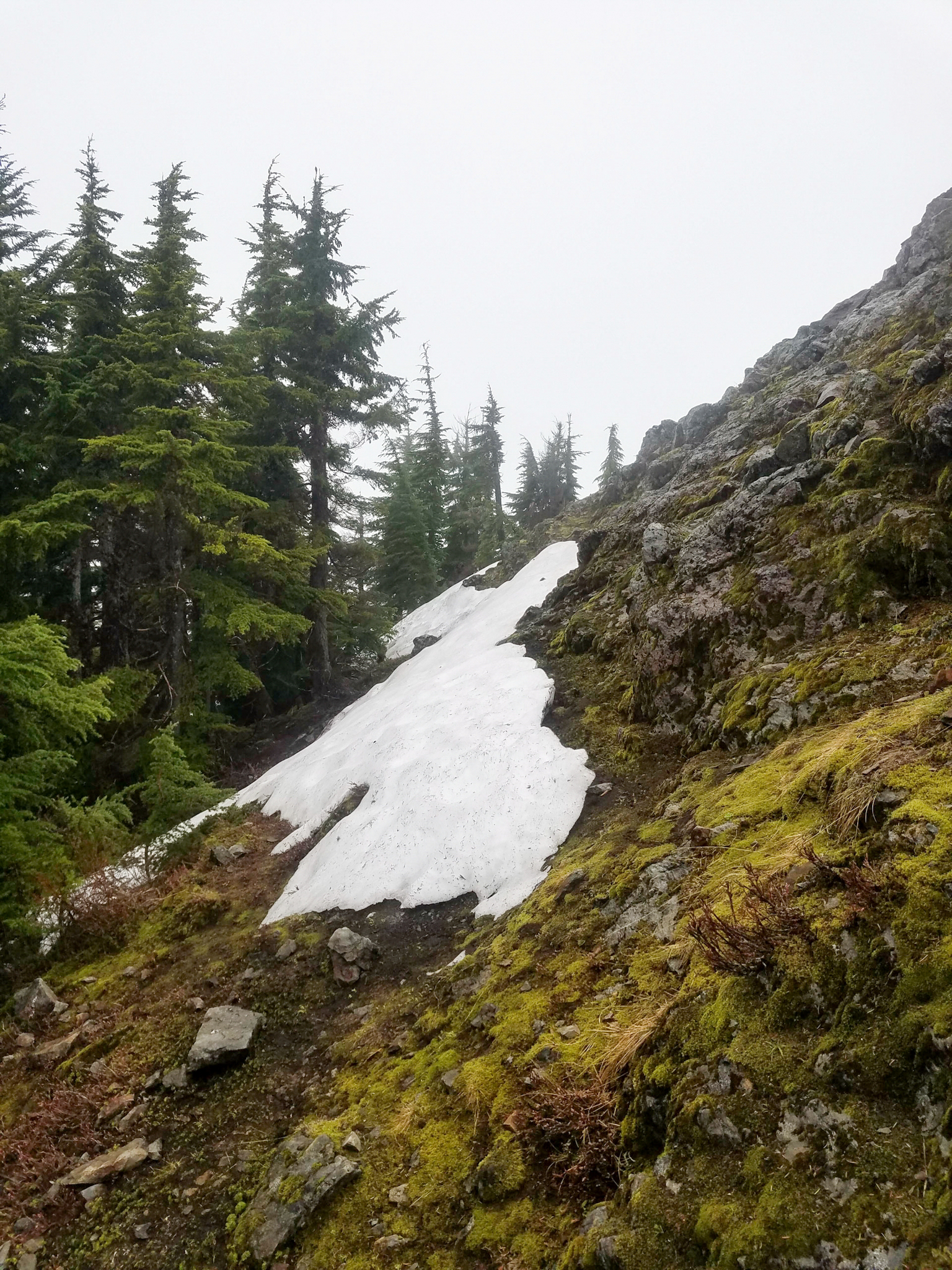
A short distance down the Colchuck Lake Trail we were again met by the angry creek and a very cool wooden bridge which leads into a small boulder field which was fun to navigate thorugh.

The trial then begins to climb with more intensity with plenty of switch backs. At one point the trail crosses across a small waterfall, we both somehow managed to keep our feet dry while crossing.

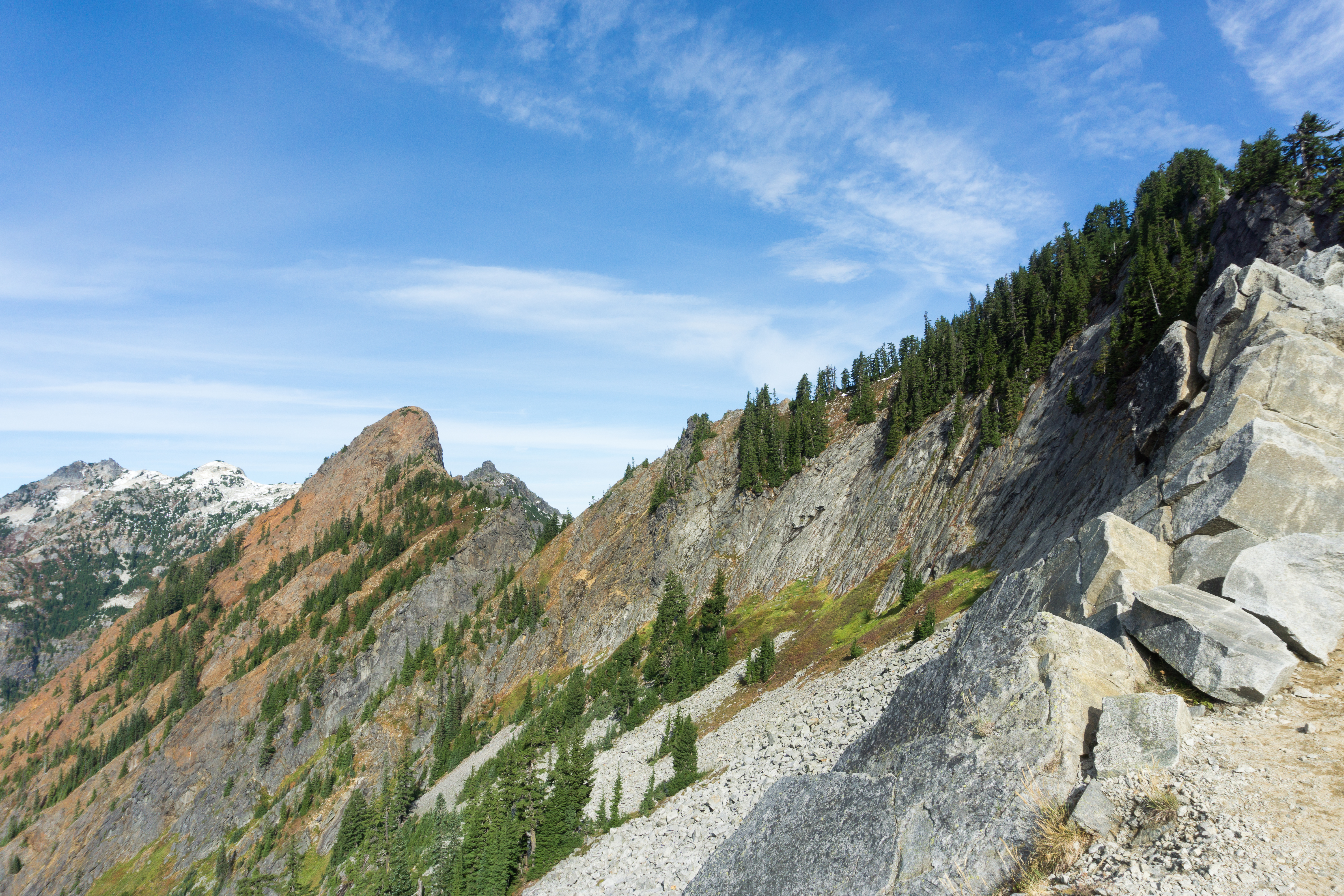
Continuing up the trail we made our way to a clearing allowing us to look back down the way we came with a stunning view of Mt. Stuart in the distance.

The trail dipped back into the tress for the final push to the lake, at one point the trail intersected with a stream which was a little tricky to navigate through. Once we arrived at the lake we were greeted by the massive Dragontail Peak and  the slightly smaller Colchuck Peak with Asgard Pass between the two, which we would have had to conquer if we had a snagged a Core permit. I think we were both a bit relived that we didn’t as watching people make their way up was a bit intimidating.


After I took a quick swim in the extremely cold lake we ate lunch and started to head back down where we came across a very hungry mountain goat who luckily had plenty to much on and was too busy eating to be concerned with us.

Once we made our way back down to the trailhead we hopped back in the car and made the quick trip over to the Eightmile trailhead to begin our hike up to Eightmile lake.

The sun was rather intense as we made our way up but I found myself distracted by the abundance of wildflowers and some tiny pine cones.

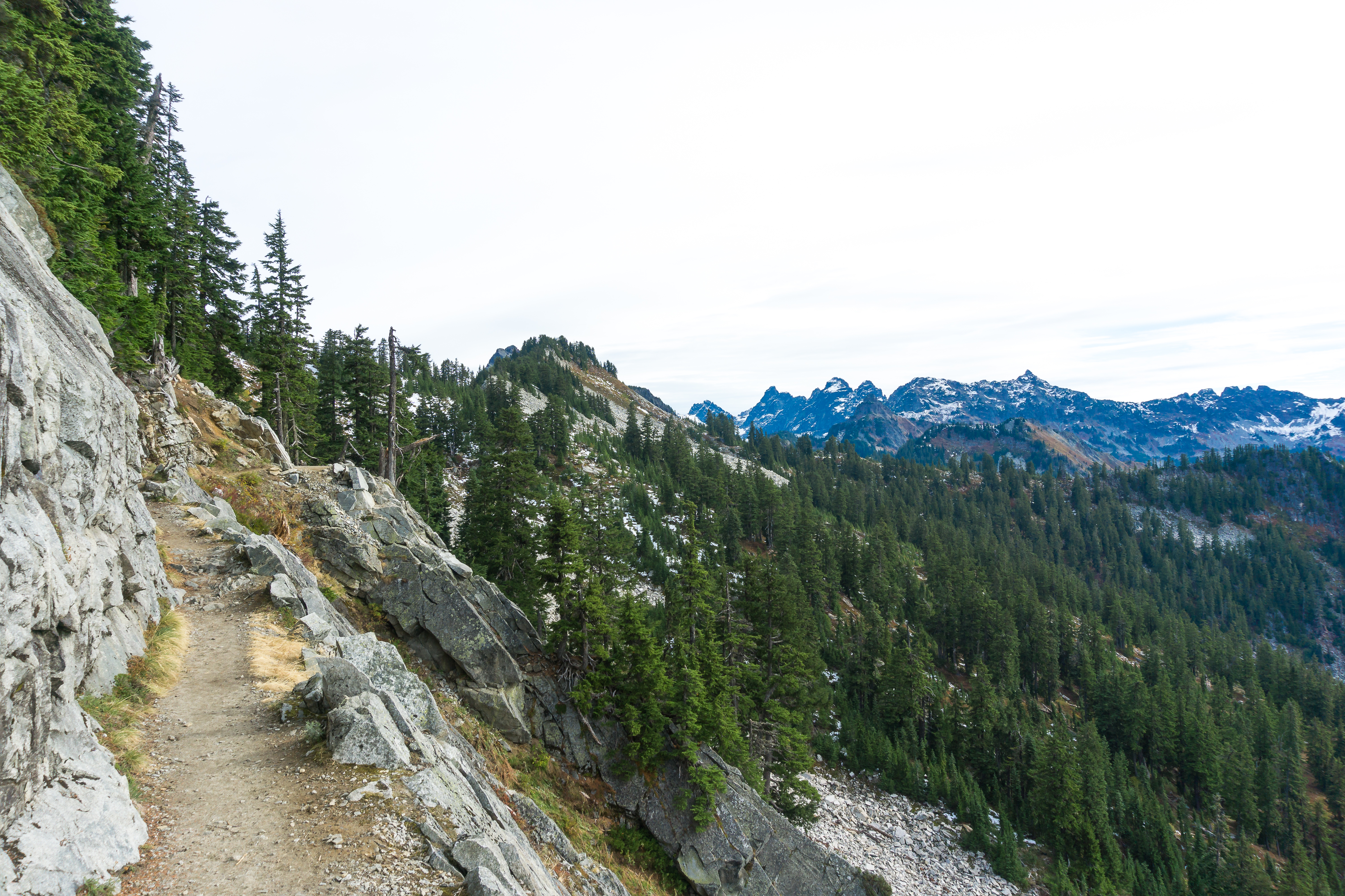
The trail to Eightmile lake is fairly flat which was a nice change of pace after the hike up to Colchuck. A few miles in we hit Little Eightmile Lake which is also the junction for Caroline Lake, which would be our destination the following day.

After a quick break we continued onward as the trail climbed a bit before we arrived at the lake. We found a site and just as I finished setting up the tent a group of very loud college girls decided to set up camp just feet from ours. We quickly packed up, grabbed our backpacks and made our way to another, much better, site right by the lake. Luckily my tent is extremely easy to set up and take down.

After getting everything set up again I took a quick swim in the lake, which was just as cold as Colchuck but it felt amazing after hiking in the sun all day. As we were having dinner one of the locals decided to come dine with us (yes, those are flowers in it’s mouth).

We were both pretty tired after a full day of hiking and after staying up late enough to see the stars decided to get some much needed rest.

The next morning we followed the trial around the lake, hopped over some trees and found another angry stream cutting through the forest.

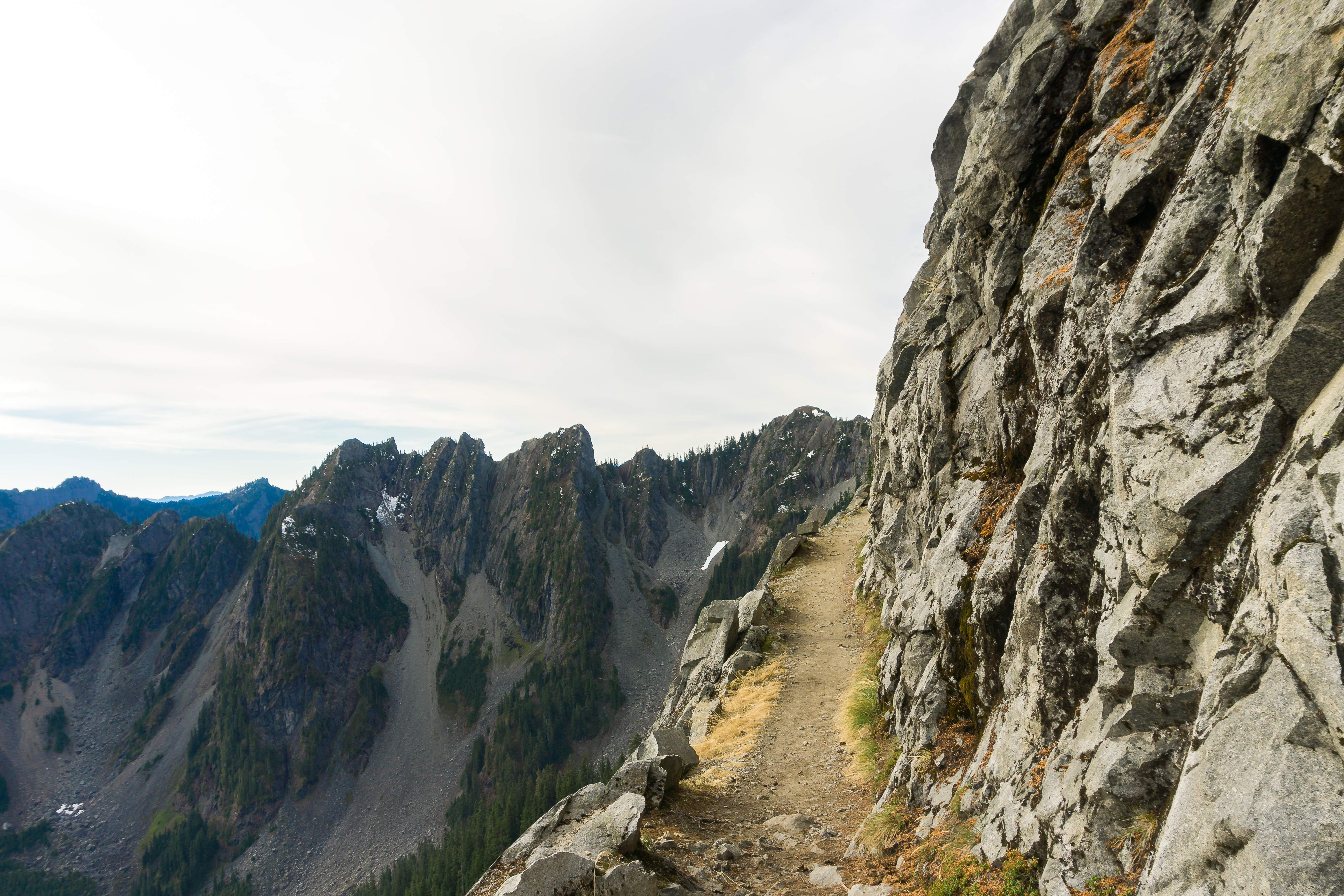
After breakfast we packed everything up and made our way back down the trail to Little Eightmile Lake where we started up the trail to Caroline Lake.  While the trail didn’t seem very difficult on paper it did prove to be a challenging hike.

The trail starts out rather steep and provides very little shade, which was sorely missed as the sun was blazing as we made our way up.  We would take a break every time we came across a bit of shade.

I even resorted to hiding from the sun in the narrow shadow of a large dead tree and soaking my hat in water to keep cool.

As I looked back down towards Eightmile lake I tried to visualize myself swimming in the ice cold water, it didn’t help.

A little further up the trail we met a couple on their way down and chatted for a bit. The said that the lake was spectacular and warned us about a Coyote they saw up at Windy Pass. We were considering making the hike up to the pass  but decided to avoid it after that.

However, as we rounded a corner about a mile later we were met by a lone Coyote standing in the middle of the trail staring us down. Considering that Coyotes are pack animals I decided to skip the photo and clanked my hiking poles above my head until he decided to head off the trail and run down into the valley. We cautiously continued to the lake without seeing or hearing another.

We found that not only were there no loud college girls at the lake but in fact there was only one other couple on the other side of the lake.  We set up camp and I took a swim in the warmer but still cold Caroline lake.  We spent the rest of the day relaxing before we were forced into the tent due to an army of mosquitoes that occupied the lake.

The next morning I somehow managed to get up early enough to catch a bit of the sunrise.

After enjoying the lack of mosquitoes at the lake for a bit we packed up camp and started our hike back down to the trailhead. We both had one thing in mind as we struggled through the heat….

…..a sausage and beer at Munchen Haus in Leavenworth!  While we didn’t end up hiking through the “real enchantments”, which is probably for the best, we made the most of our time in a really amazing place. Hopefully we can snag a core permit after I finish the PCT next year.


All The Gear, All Lined Up

When I fist started looking at gear for my PCT adventure I planned to carefully weigh my options for each item I would be bringing with me, by not only reading reviews but physically inspecting and testing items out before making my final decision. You may remember earlier posts about backpacks and tents, where I outlined different option sand attributes with the intent to dive deeper to each option. Well, that didn’t happen. After discovering the wealth of detailed reviews and ranked lists of backpacking gear I just started buying things, here is what I ended up with.

For my backpack I ended up with the ULA Circuit.  I didn’t necessarily chose this backpack, it just so happened that my brother had one that he never used and was willing to part with for $100 (Thanks, brother!).  I love how it carries and the way the hip belt moves with you while you’re hiking.

For a tent I ended up with the Big Agnes Copper Spur HV UL2. It was at the top of many lists and while I could have gone with something lighter (and more expensive), I felt better getting something I believe to be more durable and sturdy, call it my security blanket.  It’s super easy to set up and nice and roomy. I also picked up the footprint for it too. However, while the extra space of a 2 person tent is nice I’m wondering if I should switch to the 1 person version for the PCT.  I wonder if my decision was a subliminal one.

After considering going with a sleeping quilt I decided to go with a sleeping bag, the weight difference wasn’t substantial enough for me to risk having drafts of cold air attack me while sleeping. I landed on the REI Co-op Magma 10 and apparently so did a lot of other people because it wasn’t easy to track down, all the REI locations were sold out when I went to buy it. The first time I tried to buy it I had made a special trip to Portland to avoid sales tax , the second time I had a 40% off coupon for the REI friends and family sale. However, third time’s a charm; Cristina and I went to some outdoor event only to find REI was handing out 35% off coupons and had it back in stock!  The sleeping bag itself was well worth the wait and effort, it’s not named “Magma” for nothing.  I also picked up a silk sleeping bag liner to help keep it clean, I can only imagine how filthy i’m going get.

For a sleeping pad I went all out and picked up the Therm-a-Rest NeoAir Xtherm Max. I didn’t realize how important sleeping pads until I started looking into my sleep setup. With a down sleeping bag it’s the trapped air that is keeping you warm, when you’re laying on the down it is compressed causing it not to provide insulation from underneath, so a good sleeping pad will provide the insulation your sleeping bag doesn’t.  This one is nice and comfy but it does make crinkly noises when you move around it, a small price to pay for warmth.

My last major gear purchase was a new camera, the Sony A6000! I had already accepted the fact that I wouldn’t be bringing my heavy DSLR and was planning on just using my phone for photos. However, I just couldn’t do that, I need (heavy emphasis on the word “need”) an actual camera for my hike. I considered a compact point and shoot but was concerned about the lack of zoom, so I went the mirrorless route instead. Having a digital display viewfinder takes some getting used to but I’m amazed by the pictures it takes. While it barely fits in the hip pocket of my backpack I’m happy I decided to get it.

In addition to the major items here is the rest of the gear i’m taking with me.  I’ll cover clothing in another post.

  • BearVault BV500 – Extra big ass bear can! While i’m not overly concerned about bears a bear canister is required in sections of the PCT.  This thing is huge, I have yet to figure out how i’m going to carry it with me.  It does double as a seat, so I have that going for me.
  • Black Diamond Raven Ice Axe – Another item I will only need for parts of the PCT but this one is a little more important, as I learned when learning how to keep myself from sliding off a mountain in the snow. I could have gone with a lighter version but if i’m going to need it I want to make sure it’s not going to fail.
  • Leki Corklite Treking Poles – A friend of mine pretty much demanded that I get Leki poles when I started hiking seriously and I’m glad I listened. I’ve put a lot of miles on them and they’ve held up great.
  • Kahtoola MicroSpikes – Added traction for the icy bits of the trail, makes it super easy to not slip and fall on your butt.
  • MSR Titan Kettle – Since I’m planning on dehydrating a majority of my food in ziploc freezer bags (easy clean up) I really just need something to boil water in, this will be more than sufficient. It can also double as a coffee mug.
  • MSR Pocket Rocket 2 –  While I currently have another canister stove I’ve decided to pick up the Pocket Rocket 2 as it’s lighter and probably a bit more reliable than a no-name brand.  I don’t have it yet, I will soon!
  • Long Handle Spoon – With the plan to eat most of my meals out ziploc freezer bags having a spoon with a long handle will keep my hands clean. So while you think my spoon might be too big, it’s not, but this guys is.
  • Samsung Galaxy S7 Edge – Yep, it’s a phone.  The same phone I have with me every day. However, more importantly, it functions as a GPS and there are some great PCT apps out there, some of which I mention in my PCT Resources post.
  • Sawyer Squeeze Water Filter – This water filter and I are going to be best friends. I’ve used a Sawyer Squeeze on my backpacking trips and while it takes a little work it gets the job done. Not to mention it fits perfectly on top of a smartwater bottle, which my backpack is designed for.
  • Generic First Aid Kit – I’d link to it but i’m not sure what brand it is. I’ll probably switch it out with a more compact single use kit.
  • Huntsman II Swiss Army Knife –  It took me a while to find a pocket knife that had scissors, a can opener, bottle opener, saw and tweezers.  This one has me covered.
  • The Deuce Of Spades –  Super lightweight, just a tad over half an ounce, shovel for digging holes. I mean how could I not buy it with a name like that?
  • Generic USB Battery Pack – The one I have now is nothing that special, i’ll probably upgrade it soon. Not only can I use it to charge my GPS (phone), it can also charge my camera as well!
  • Klymit Pillow X – Tiny little inflatable pillow. I’ll probably end up using my puffy jacket as a pillow most nights.
  • Petzl Tikkina Headlamp – Cristina had an extra so I adopted it as my very own, the one I had wasn’t very bright. Might look into upgrading it to something even brighter! (not pictured)
  • Sunto A-10 Compass – A compass that works great!  However, I should probably upgrade to one that I can adjust the declamation on.
  • Other Stuff – A lighter, tooth brush, tooth paste, dr. bonner’s soap and a camp towel.

While this is a lot of stuff it does fit in my backpack with room for my clothing and food, both of which I’ll cover in a future post.  Wait, I feel like i’m forgetting something….. that always happens to me when I’m packing for a big trip.

Return to Mount Teneriffe

After not making it to the top of Mt. St. Helens  I got the itch to summit something.  I started to consider my options for an after work hike, something that would only take a few hours, a short drive from Seattle, and allow me to stand on the tippy top of something.  I considered a few different hikes, some were too far away, some were too long but Mt. Si seemed just right. While it wasn’t anything exciting or new,  it is just a short drive from work and it had been a while since I climbed all the way up the haystack.  Plus the trail traffic would be at tolerable levels during the week.

So one day after work I made my way to the Mt. Si trailhead and started up the mountain. As expected the trail wasn’t busy at all, I only passed a handful of people on my way up, not something you’d experience on a weekend.  About an hour and a half later I was nearing the top and after navigating over the false summit I arrived a the scramble.

I remember the first time I stood at the bottom of the scramble, nervously thinking that there was no way in hell I was going up. I watched as a few hikers easily navigated up the rocks and figured if they could do it so could I, eventually convincing myself to make my way to the top.. very slowly.  This time, I was excited to see how quickly I could make my way up.  I found a path and scrambled my way up to the top.

On my way up I couldn’t help but feel the need to start climbing again, and by “again” I mean since those two months I spent in a climbing a few years ago. Looking back down was a bit intimidating but I didn’t have to worry about that yet.

At the top of one scramble I was met with the other, much shorter, one. While it is shorter a misstep would result in a pretty bad fall.  I  carefully made my way to the summit and took a moment to take in the views.

I looked back down the side of the mountain and while I felt like I accomplished something It still didn’t fill the void left by Mt. St. Helens. Don’t get me wrong, It was a great feeling to stand at the top and the views were amazing, but it  just wasn’t the challenge I was looking for. 

Looking east towards the Cascades I started to look for another peek to climb that weekend , when the obvious became clear.  I had to return to the only hike I didn’t finish this year, the only way to make up for one incomplete hike was to finish another incomplete hike.  I was heading back to Mount Teneriffe.

Early Sunday morning I made my way to the tiny Mount Teneriffe trail, threw on my backpack and started out. I was on a mission and quickly conquered the flat bit before starting to head up the rocky switchbacks.

The foxgloves were out in force as I made my way up past Teneriffe falls, not stopping to take a picture,  and practically climbed my way up to the top of the ridge.  I took a break to look around and found that like last time I was surrounded by clouds. I continued on ran into another hiker making her way up the trail.

As I got ready to pass her she asked me which way the trail went. She followed me up for a bit before I stopped again to throw on another layer and she continued on I eventually caught up to her and she once again asked me which way the trail went.  As continued up I thought about my last attempt Mt. Teneriffe and remembered where I was when I turned around, before I knew it I had my way to that point.  Knowing that I still had I ways to go I pushed on.

However, I discovered that the trail wasn’t as long as I remembered. After I made my way through another grouping of trees I came to the clearing right before the summit, which still had a bit of snow, the thing that made me turn back last time.

I crossed the snow and made my way to the summit, completely clouded in and windy. I still took a few minutes to look around and enjoy  finally making it back to the top.

I walked around the top and found the marker. When I looked over the edge all I could see is white.  While it didn’t have great views like Mt. Si it was a much more rewarding experience. It was both mentally and physically challenging, and what feels better than overcoming failure and completing a goal. Now I just need to go back to Mt. St. Helens…